
2023/2025 Iowa Snowdrifters Map (Front and Back)
This is the map for the 2023/2025 season.
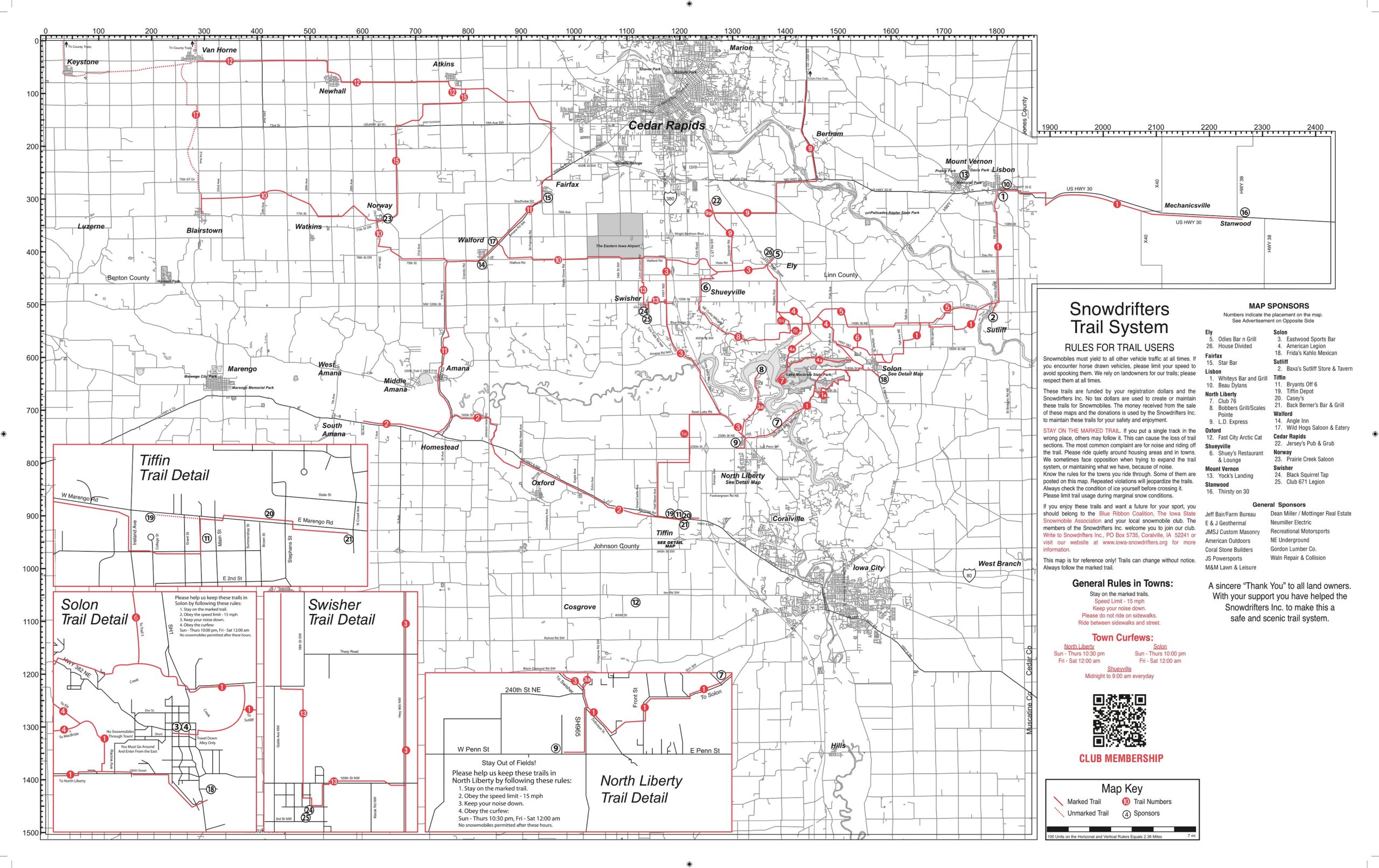
Our map is printed every 2 years so, there have been some changes. You can find the changes under Trails>Map Updates
You can find physical maps at the following locations
We are also working with Polaris Trails apps for your phone to keep our maps up to date. We have provided Polaris all our updates and it is up to them to load them into the mobile app.
Snowmobile Clubs Around Iowa City/Cedar Rapids
North: The Frozen Few Snowmobile Club
Jones County Snowchasers
South: Eastern Iowa Sledheads Snowmobile Club
East: Eastern Iowa Sno-Riders
East: Scott County Sno-Seekers
Other Groups Close to Iowa City/Cedar Rapids Maps
North East Iowa Snowmobile Map (Starting just north of Waterloo)
